
🗺️ At a glance
- What it is
- A four-island residential fishing village between Naples & Marco
- Where
- Off Collier Blvd (CR-951), at the north edge of the Marco Island approach
- Vibe
- Quiet, low-rise, dock-lined — a couple of waterfront tiki spots, no high-rises
- Why boaters love it
- A central marina launch hub for Capri Pass, Keewaydin, Naples & Goodland
- On the water
- Mangrove creeks, oyster bars, dolphins & wading birds right out the channel
Where the Isles of Capri actually is
Heading down Collier Boulevard from Naples, the Isles of Capri is the last patch of land before the long causeway lifts you over to Marco Island. Turn off the main road and you drop onto four small islands — locally called the four “keys” — stitched together by short bridges and ringed almost entirely by docks. It sits right where the freshwater backcountry meets the salt, with Capri Pass opening to the Gulf on one side and a tangle of mangrove bays on the other. That in-between position is the whole story here: you're tucked behind the islands but minutes from open water.
It's a real neighborhood, not an attraction. People live here on stilted homes with boat lifts, and the closest thing to a downtown is a cluster of waterfront restaurants where shrimp boats and skiffs tie up for lunch. If you want lights and traffic, that's Marco Island a few minutes south.
What the village is like
The Isles of Capri has the feel of old Florida that Marco mostly traded away in the 1960s. No high-rises, no chain rows — just low homes, a marina or two, and a handful of dock-and-dine spots where you can watch dolphins roll through the channel while you eat. The water around it is shallow and rich: oyster bars, seagrass and mangrove shoreline, the kind of mangrove ecosystem that holds snook, redfish and wading birds year-round. Mornings here are quiet enough to hear mullet jump.
For visitors, that calm is the appeal. It's a soft landing between the energy of Naples Bay and the wilder backcountry to the south. Plenty of people use Capri as a base, eat a leisurely lunch on the water, and let a captain handle the running around.
What it opens onto
This is why we keep coming back to Capri: almost everything good on this coast is a short run from its channel. The chart below is how we think about a day launched from this part of the water.
| Destination | What's there | Roughly |
|---|---|---|
| Capri Pass | The Gulf inlet & dolphin highway right out front | Minutes |
| Keewaydin Island | Boat-only barrier-island shelling & beach | Short run north |
| Goodland | Old fishing village, gateway to the islands | Short run south |
| Ten Thousand Islands | Mangrove backcountry & uninhabited keys | South & east |
Because of that central position, a trip from here can be almost anything. Want beach and shells? We run our shelling tours out to the islands the tide just refilled. Want fins? Capri Pass and the surrounding flats are some of the most reliable dolphin water on the coast, which is exactly where our dolphin tours work. Either way, the Isles of Capri does its best job as a doorway — the quiet front porch of a very big, very beautiful stretch of Gulf coast.
From the Helm: Isles of Capri: threading the Capri channel around Marco’s afternoon traffic
Guests ask about the Isles of Capri more than almost any other quick stop on the way out, usually right after we idle past the marina and someone at the rail says the place looks smaller than the map made it seem. We like pointing out that most of what you’re looking at from the water is seawall and short private docks, strung together tight enough that the community reads as one long ribbon of homes rather than the scattered map view guests remember from checking directions beforehand.
The channel threading past Capri carries a noticeable current on a strong tide, funneled by the causeway bridge pilings, and our captains hold a tighter line through that stretch than the open water on either side calls for. A boat drifting even slightly wide on an outgoing tide gets pushed toward the shallower flats faster than the current speed suggests, so we treat the crossing as its own small decision. We watch the surface at the pilings for a telltale boil or hard seam before picking a lane through.
Past the bridge we’ve got two ways to keep working the morning, and which one we pick depends on what we’re after. Duck west into Johnson Bay and the water goes quieter and shallower fast, good for an easy look at wading birds when guests want a slow, close-in stretch. Hold the main channel instead and you’re pointed toward the wider run past Rookery Bay and the backcountry beyond it. We read the wind and how much patience the group has left before choosing.
From the helm, Capri sits at an odd kind of crossroads — working docks and modest homes on one side, open water toward the backcountry on the other, with nowhere near the boat traffic the main channels carry on a busy afternoon. It’s usually the quietest stretch of water in the first fifteen minutes of a trip, and we’ll often ease off rather than push speed we don’t need yet this early out. Someone at the rail almost always asks where the other boats went.
We also use that quiet stretch as a gut-check on conditions — if the water inside the channel already has a noticeable chop working against the current, the open bay past the bridge is usually running rougher than the morning forecast let on, and we’ll adjust the route before we’re committed to it. If the tide turns harder than expected mid-crossing, we’ll sometimes hold inside Johnson Bay a while longer and let the push ease before threading back out through the pilings.
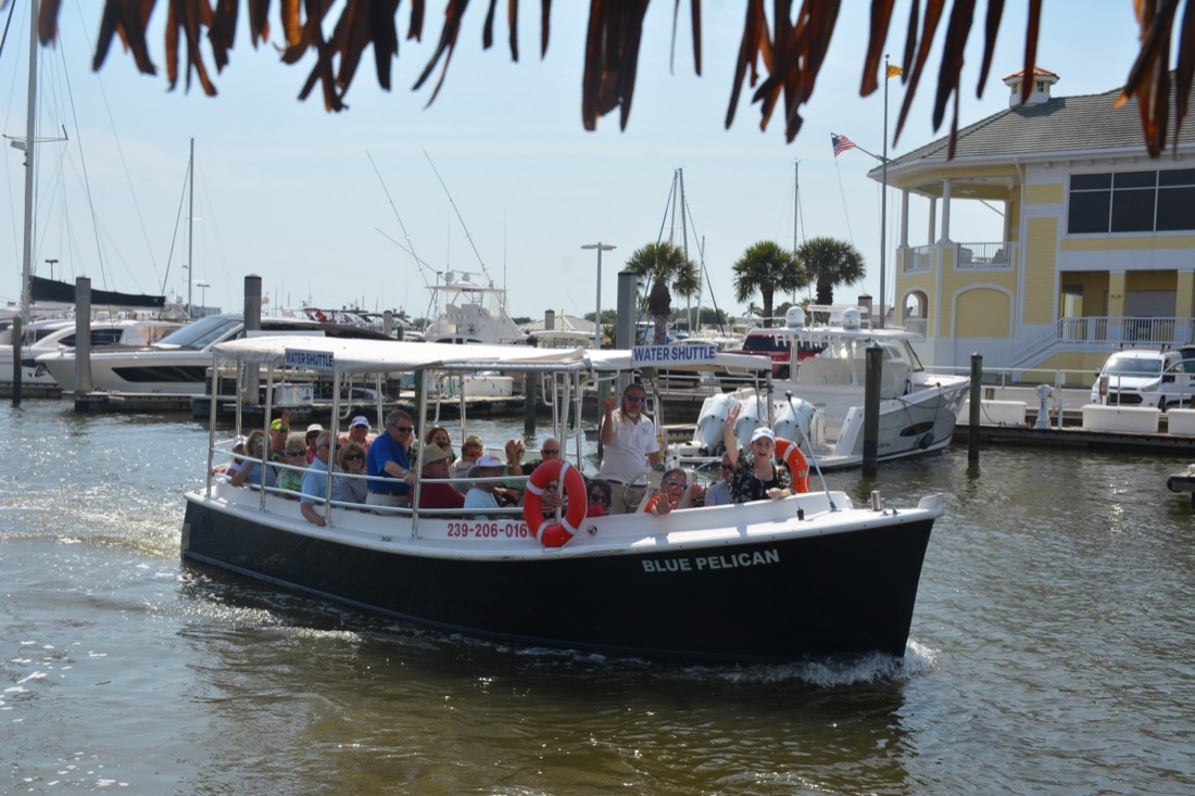
On busy season weekends when traffic backs up near the main Marco bridges, we’ll route through Capri’s channel to dodge it, trading a slightly longer track for calmer water and a steadier ride. That’s really what Capri is from a captain’s seat: less a destination than a hinge in the route, the point where we decide which way the morning runs. We use it as a flexible pickup option for water shuttle guests who’d rather board somewhere quieter than Marco’s busier marinas, and as a quick weather-check stop before committing toward Goodland and beyond.