
🌊 At a glance
- Estuary
- Where fresh water meets salt water — the nursery for most Gulf species
- Mangrove
- Salt-tolerant trees whose prop roots shelter juvenile fish and shrimp
- Flats
- Shallow, often grassy water where captains look for tailing fish
- Oyster bar
- A living reef that surfaces at low tide, sharp underfoot and full of life
- Rookery
- A nesting or roosting colony for herons, egrets and other wading birds
The Water Words: Estuary, Brackish and Backwater
An estuary is simply the place where a river’s fresh water meets the Gulf’s salt water and the two mix instead of staying separate. That mixing zone is brackish water — not quite fresh, not quite salty — and it’s what’s under your hull for most of a run through the Ten Thousand Islands. Salinity here actually shifts by the hour: it climbs on an incoming tide and drops fast after a hard summer rain, which is part of why relatively few species can live in an estuary full time, and why the ones that do — snook, redfish, oysters, blue crab — are some of the toughest, most adaptable animals in the Gulf.
Backwater is the local shorthand for the skinny, mangrove-walled water off the main channels — the kind of place a big offshore boat simply can’t follow, and a shallow-draft skiff can. Your captain ducks into the backwater to get out of the wind, to sight-cast at a tailing redfish, or just to show you a corner of the islands most visitors never see from a dock. A tidal creek is one specific backwater feature: a narrow, winding waterway that only really fills on an incoming tide and can shrink to nearly nothing at dead low. Local captains read tidal creeks almost like a road map, knowing which ones flush clean and fast on the tide and which ones silt in and go to mud.
The Habitat Words: Mangrove, Flats, Seagrass and More
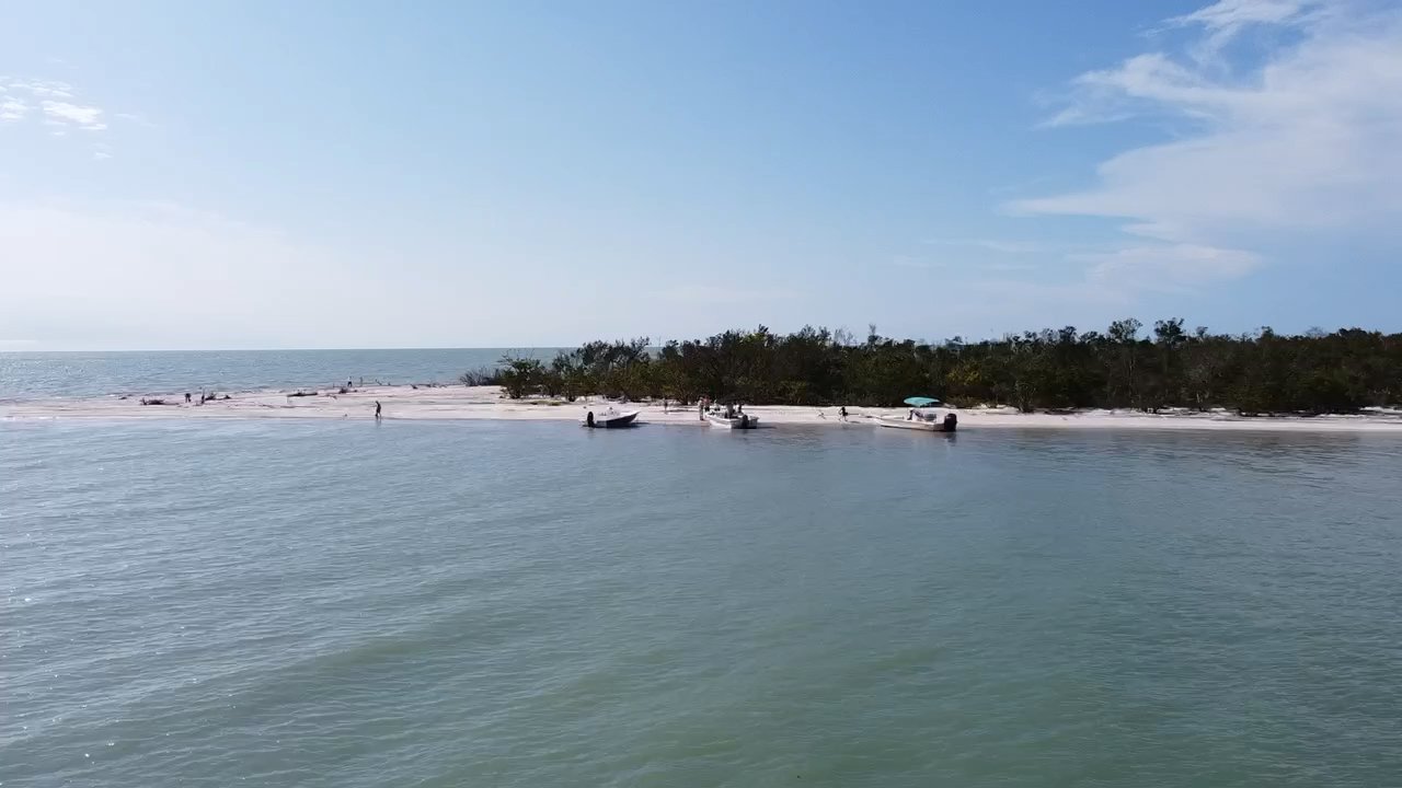
Mangrove is the word you’ll hear more than any other out here. Three species — red, black and white mangrove — wall nearly every shoreline in the Ten Thousand Islands, and the red mangrove’s tangled, above-water prop roots are the whole reason this ecosystem works. They trap leaf litter and algae, break wave energy before it erodes the shoreline, and give juvenile snook, snapper and shrimp somewhere to hide from bigger fish. Most of these islands have no bridge or road reaching them at all, which is exactly why a boat is the only way in — our mangrove ecosystem guide goes much deeper on how it all fits together.
Flats are the shallow, often grassy stretches of open water between the mangrove islands — a foot or two deep, sometimes less, and usually the first place a captain slows down to look for a tailing fish or a stingray gliding along the bottom. Seagrass is what carpets a lot of those flats: turtle grass and shoal grass meadows that anchor the whole food web and give young fish cover to grow up in before they move out to open water. A mudflat is a flat without the grass — just soft, dark sediment that’s underwater at high tide and exposed, glistening and dotted with fiddler crab holes, once the tide falls.
An oyster bar, meanwhile, is a living reef: thousands of oysters cemented together into a ridge that surfaces at low water, sharp enough to cut bare feet and thick with the crabs, small fish and wading birds that come to feed on it. Both mudflats and oyster bars are classic backwater features your captain tracks on the tide chart, because running over one at the wrong stage of tide is the fastest way to end up aground.
Wildlife Words: Rookery and the Nursery Connection
A rookery is a nesting or roosting colony — a stand of mangrove islands where wading birds like herons, egrets, white ibis and, if you’re fortunate, a roseate spoonbill gather by the dozens to nest or settle in for the evening. Rookery Bay National Estuarine Research Reserve, just north of Marco Island, takes its name from exactly this behavior — roughly 110,000 acres of the same mangrove-and-flats habitat protected specifically because it’s such productive ground for nesting birds and juvenile marine life.
Speaking of which: nursery is the word biologists use for the whole estuary system, and it is genuinely the single most important idea behind every term on this page. Redfish, snook, tarpon, shrimp and blue crab all spend their first months tucked into mangrove roots, seagrass beds and tidal creeks where predators have a harder time reaching them, then move out to open Gulf water as they mature. That’s also part of why bottlenose dolphins, which live in these waters year-round, work the edges of the flats and oyster bars — they’re hunting the very same nursery that raised the fish they eat. None of it is guaranteed on any single outing, but understanding the habitat is exactly why our captains know where to look first.
Why These Words Matter on the Water
None of this is trivia. When your captain says something like “we’re ducking into the backwater” or “that’s an oyster bar, watch your footing,” knowing the word means you understand what’s actually happening instead of just watching scenery go by. A trip through the Ten Thousand Islands is really a tour through a working nursery, not a manicured waterway, and this vocabulary is the fastest way to actually see what you’re looking at.
It connects directly to what you’ll do out there, too. A dolphin tour spends real time working the flats and oyster bars where bottlenose dolphins hunt the estuary’s nursery grounds. A shelling tour runs you out to boat-only barrier islands shaped by the same tidal creeks and backwaters described above. And if you want the other half of the vocabulary — slack tide, channel marker, draft and the rest — our companion tide and water words glossary covers it. Put the two together and you’ll step onto the boat already speaking the language, which is a different experience than just watching the Ten Thousand Islands roll by without knowing why they exist in the first place.
| Term | What it means | Where you’ll hear or see it |
|---|---|---|
| Estuary | Where fresh river water mixes with Gulf salt water | Everywhere in the Ten Thousand Islands |
| Brackish | Water that’s partly fresh, partly salty | Backwaters and tidal creeks |
| Backwater | Narrow, mangrove-walled water off the main channels | Wherever your captain gets you out of the wind |
| Tidal creek | A narrow waterway that fills and empties with the tide | Deep in the mangrove maze |
| Mangrove | Salt-tolerant trees that build the shoreline and nursery habitat | Lining nearly every island |
| Flats | Shallow, open water between islands, often grassy | Where captains slow down to look for fish |
| Seagrass | Underwater grass beds that anchor the food web | Carpeting many of the flats |
| Mudflat | A grass-free flat exposed at low tide | Along backwater edges at low water |
| Oyster bar | A reef of live oysters that surfaces at low tide | Marked on every local tide chart |
| Rookery | A nesting or roosting colony for wading birds | Rookery Bay and quiet mangrove islands |