
🗺️ At a glance
- What it is
- A maze of mangrove & shell-mound islands
- Where
- Gulf coast between Marco Island and Everglades City
- How many
- Thousands of islets — far more than “ten thousand” is literal
- Why it's wild
- Almost no development; dense mangrove concentrates wildlife
- Tour from
- Goodland reaches the closer islands
What the Ten Thousand Islands actually are
The name is a tease — nobody's counted them, and the real number runs into the thousands of separate islets. What you've got is a roughly 35-mile stretch of Gulf coast that fractured into a maze of mangrove islands divided by tidal creeks, bays and passes. There's essentially no development out here: it's wrapped up in the Ten Thousand Islands National Wildlife Refuge, Rookery Bay, and Everglades National Park, so what you see from the boat is close to what the Calusa saw a thousand years ago. No roads reach it. The only way in is by water, which is exactly why it stays wild.
How the islands formed
Two builders made this place, and you can still see both. First the mangroves: a red mangrove seedling lodges on a shallow oyster bar, its prop roots trap sediment and shells, and over decades a bar of mud becomes a tree, then a clump, then an island. Second, and this is the cool part, the Calusa — the powerful pre-Columbian people who lived here — piled up enormous mounds of discarded oyster and whelk shells over centuries. Those shell mounds became the highest, driest ground out here, and many of the larger islands like Dismal Key and Key Marco sit on them. So some islands are pure mangrove, and some are literally built on ancient shells.
Why the wildlife is so dense
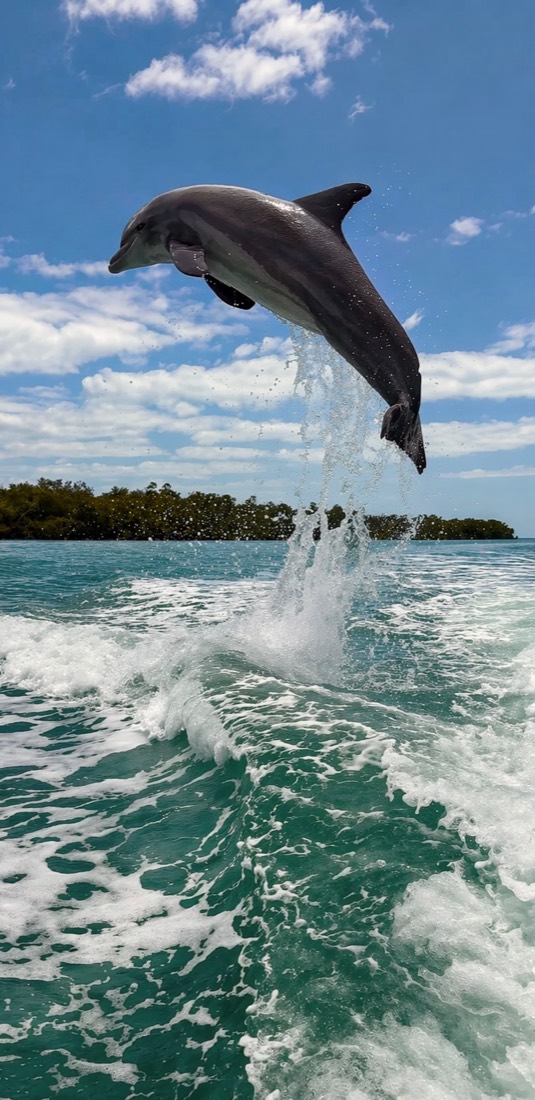
Dense mangroves plus twice-daily tides plus zero development add up to a wildlife magnet. The root tangles are a nursery for fish, the fish feed the dolphins and birds, and the lack of crowds means animals behave naturally. On a given run you might watch bottlenose dolphins work a creek mouth, spot an eagle on a snag, slide past a roseate spoonbill flushing pink off a flat, and — in the cooler months below about 68°F — find manatees tucked into the warmer creeks. It's not a zoo and nothing's guaranteed, but the odds out here are about as good as Florida gets.
What a tour from Goodland reaches
Here's the honest picture. The Ten Thousand Islands run all the way to Everglades City, but a half-day tour isn't crossing the whole thing — it doesn't need to. From Goodland, the little fishing village on the back side of Marco, our captains reach the closer, richest cluster of islands fast: the creeks and bays around Coon Key, the flats off the nearer mangrove keys, and the protected water where dolphins and birds concentrate. You get the real Ten Thousand Islands experience — the wildlife, the solitude, the maze — without a marathon run.
| Feature | Detail |
|---|---|
| Location | Marco Island to Everglades City |
| Island types | Mangrove islets & Calusa shell mounds |
| Access | Boat only — no roads |
| Protected by | National Wildlife Refuge, Rookery Bay, Everglades NP |
| Best wildlife | Dolphins, eagles, spoonbills; manatees Nov–Mar |
Want to actually go? Our dolphin and wildlife tours and Ten Thousand Islands runs launch right into this maze.
From the Helm: running the mangrove maze between Dismal Key and Gullivan Bay on a dropping tide
Cut the engine off Dismal Key on a dropping tide and the maze goes quiet fast — no wake, no chatter, just current sliding past mangrove roots and the tick of oyster shell against the hull. That hush is the point. Deep in the Ten Thousand Islands, the animals give themselves away in the water long before you spot fur or feather: a soft mud boil where a ray spooked off the bottom, a slick patch where a school just balled up, a stack of white birds working one corner of a bar like they know something you don’t. We read those signs first, then go looking for what made them.
Once we spot the tell, the boat does the talking. We come off plane well before the creek mouth and idle the last stretch, letting the current do most of the steering so the hull barely disturbs the surface. On a falling tide, water spills off the flats into the main channel and pushes bait — and whatever’s hunting it — toward the deeper cuts. We’ll nose up along the mangrove edge rather than the open middle, cut the wheel dead, and drift, because a stationary hull reads as background to a dolphin or a wading bird in a way a moving one never does.
That’s usually when we wave you to the rail and point instead of talk. A raised hand toward a bar means look low, along the exposed mud, where herons and ibis work the shrinking puddles. A finger toward open water usually means a dorsal fin is about to surface, and we’ll ease the throttle rather than gun toward it. Guests are often surprised how much of a good sighting comes down to patience and a quiet hull rather than horsepower — we’d rather sit on a spot five extra minutes than chase and blow out whatever’s working there.
When Dismal Key is running murky — a stiff onshore breeze will do that by afternoon — we’ll swing the route into Gullivan Bay instead, where the mangrove shoreline breaks the chop and the water usually clears closer to the bottom. Both spots hold the same cast of characters, just on different clocks: birds work the falling tide, while dolphins tend to show wherever the bait is stacking regardless of the hour. We choose the run each morning off wind and tide rather than habit, since the backcountry never sits still long enough to fish the same plan twice.
It’s a different kind of watching than reading about the islands on a page — you feel the current tug the drift, hear mullet skip before you see them, and get honest odds instead of a guarantee. If wildlife is the reason you want out here, our dolphin tours run this exact backcountry, and the wildlife guide is a good place to see what else shares these creeks with the dolphins and birds you’ll meet on the water.