
🗺️ At a glance
- What it is
- Shifting offshore shoals and sandbars south of Marco Island
- Key fact
- The islet eroded out from under the dome houses, which now sit in open water
- Behavior
- Storm-fed flats, constantly reshaped by wind, tide and hurricanes
- For boaters
- A genuine tide and navigation hazard — depths change
- Best seen
- By boat, with a captain who knows the current bottom
What the shoals actually are
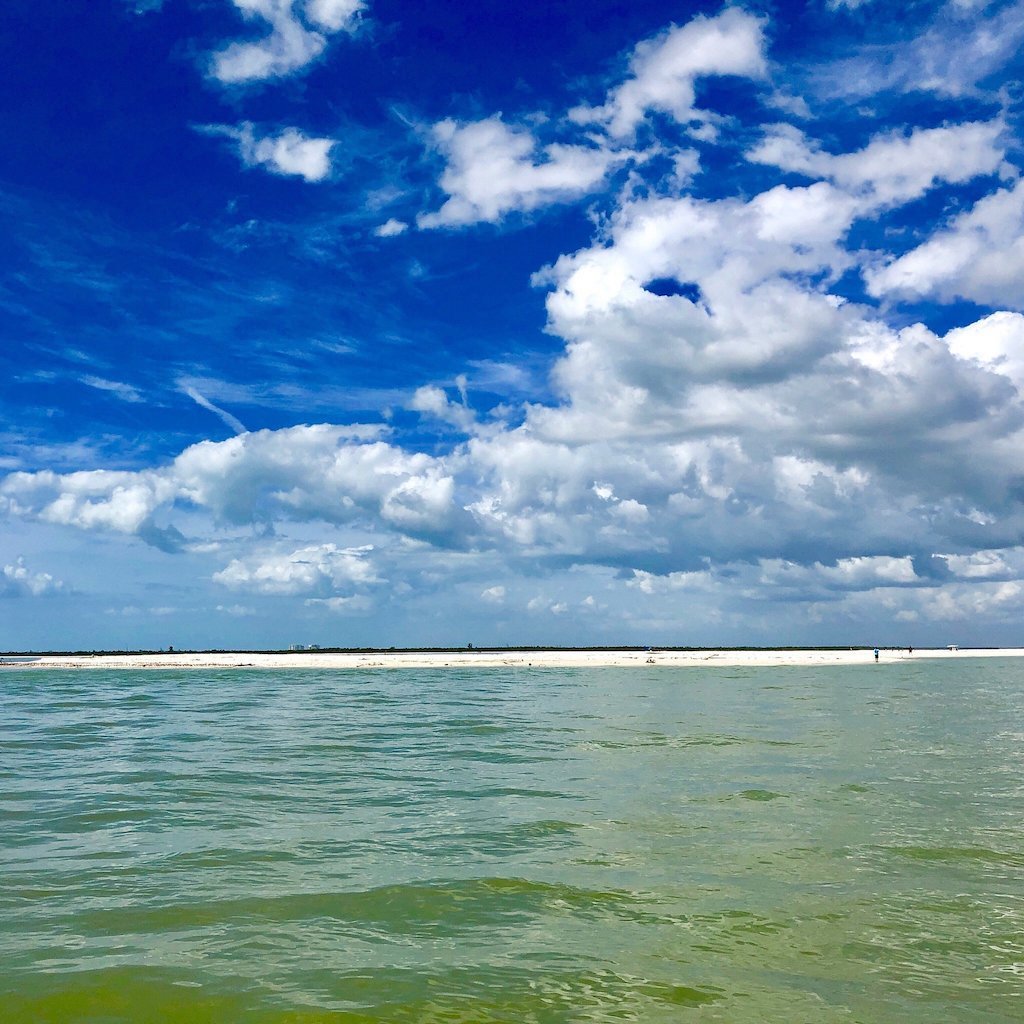
A shoal is simply a place where sand piles up shallow enough to be a hazard — sometimes breaking the surface as a bar, sometimes lurking just under it. Around Cape Romano the bottom is a whole field of them: ridges and humps of sand sorted and re-sorted by the Gulf. At low tide some emerge as bright sandbars you can stand on; at high tide they vanish. They make for gorgeous, glassy flats and excellent bird and ray habitat, but they also mean the navigable channel here is never quite where it was last season. This is the southern doorstep of the Ten Thousand Islands, where a built coastline finally gives way to a wild, water-built one.
Why this coast keeps shifting
Cape Romano sits at a hinge in the coastline where Gulf currents, tidal flow, and the sand they carry all converge. Sand is constantly being delivered, stolen, and re-deposited, so the islet and its bars are always on the move — and every big storm rewrites the map overnight. That’s the literal explanation for the dome houses ruins: built on dry land in 1982, the structures were gradually undercut as the shoreline retreated, until they stood in the surf, and then Hurricane Ian toppled what was left in 2022. Watch this place over a few years and you’re watching geology happen on a human timescale, which is rare and a little humbling.
Reading the water out here
For anyone running their own boat, the Cape Romano shoals demand respect. Charts age quickly because the bottom moves, depths swing hard between tides, and a channel that was deep last winter can shoal up by spring. The shallow bars are also home to stingrays and feeding birds, so going slow isn’t just safe, it’s rewarding. This is the main reason we send guests out with a captain rather than a rental wheel — we’re reading the current sandbars in real time. Come see the shoals, the wild edge of Cape Romano, and the dome ruins on one of our island runs; start with a shelling tour or browse Marco Island boat tours.
| Tide | What you see |
|---|---|
| Low | Bright sandbars emerge; shallow flats expose |
| Rising | Bars submerge; channels change depth fast |
| High | Open water hides the hazards beneath |
| After a storm | Bars and channels can be entirely rearranged |
From the Helm: Crossing the Cape Romano shoals on a stacked west wind against an ebb tide
Every run past Cape Romano, we’re making a call before we ever reach the shoals: cross the shallow hump close in, or swing the long way around through deeper water. A west wind stacked against a falling tide is the combination that makes up our mind for us — it piles a short, steep chop right over the shallowest part of the bar, and that’s not a ride we put guests through just to save five minutes on the clock.
When we do cross close, we’ll run it on the last of a rising tide rather than a dead-low, and we hold the throttle steady instead of chopping it back and forth. A sudden drop in RPM right over a shoal is how a prop finds sand it never saw coming. Our depth sounder gets watched harder here than almost anywhere else we run, because the numbers on the chart plotter are a starting guide out here, not gospel, on a bottom that rebuilds itself after every storm that passes through.
From the helm you can usually pick out the shoal edge before the sounder ever confirms it — a pale, almost turquoise stripe against the darker green of deeper water, sometimes with a visible ripple line where current piles up over the shallow spot. It’s a distinct enough color break that guests standing at the rail spot it and ask what it is before any of us has said a word.
On the roughest days we skip the inside crossing entirely and run the outside arc toward open Gulf water instead, adding a few minutes to the trip but keeping the ride smooth the whole way. We’d rather explain why we’re taking the long way around than have anyone white-knuckling the rail through a stretch of standing waves that a short detour avoids completely.
We also keep a mental note of which humps have moved since our last trip through, because a channel that ran clean a month ago can shoal in overnight after a strong blow. It’s less about memorizing a fixed line and more about treating every crossing as its own read, built fresh from that morning’s wind, tide and whatever the sounder is telling us in the moment.
Winter cold fronts and summer thunderstorm blowouts reshape the shoals differently, too. A front tends to push sand in a straight line, building a longer, more predictable hump we can mark and remember for weeks. A single hard summer squall can dump enough current through here overnight to carve a whole new cut where the old one used to run, which is why an afternoon crossing in rainy season sometimes looks nothing like the same water we ran that same morning.
That shoal has reshaped this whole stretch of coast, which is exactly why it’s worth seeing from the water as part of a run toward Cape Romano or a longer shelling tour further into the Ten Thousand Islands.