
🗺️ At a glance
- What it is
- Undeveloped boat-only barrier island, ~2 miles of beach
- Where
- Just south of Marco Island’s high-rises
- Getting there
- By boat through Caxambas Pass
- Nearby
- Cape Romano dome ruins lie just to the south
- Rule
- Collier County — empty shells only, no live collection
A wild island in the shadow of the high-rises
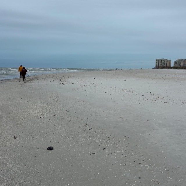
What makes Kice special is the contrast. Stand on its Gulf beach and you can look north and see the towers of Marco Island, yet around you there’s nothing but sand, sea oats, low dune, and the tracks of shorebirds. It’s the same barrier-island system as Keewaydin to the north and Cape Romano to the south — a chain of undeveloped sand the developed coast simply never reached. Because no road touches it, the beach stays quiet and the shelling stays good. This is the island locals point to when a visitor asks where the “real” Marco beach went.
Getting to Kice through Caxambas Pass
The doorway to Kice is Caxambas Pass, the inlet at the south end of Marco Island. Boats slip out of Caxambas, swing south, and the north tip of Kice is right there — one of the shortest boat-only runs on this whole coast. That convenience is exactly why we love it for a half-day: you’re on a genuinely wild beach within minutes of leaving the dock. The pass itself shifts with the tides and sandbars build and move, which is one more reason to come with a captain who reads this water rather than guessing your way in. We cover the shell side separately on the Kice Island shelling guide.
What to do on Kice Island
Same wild-beach menu as the rest of the chain: walk the long empty strand, swim off the boat in the clear shallows, and hunt the wrack line for whatever the last tide dropped. Kice gets honest shelling pressure precisely because it’s boat-only, so you’re working sand that hasn’t been combed flat. Watch the pass for dolphins riding the current and the flats for wading birds — the same mangrove wading birds that work the back bays. Keep it light and leave-no-trace: this is Collier County, so empty shells only, nothing alive. Ready to go? Hop on one of our shelling tours or look over the full set of Marco Island boat tours.
| Feature | Detail |
|---|---|
| Access | Boat only, via Caxambas Pass |
| Beach length | Roughly 2 miles of open Gulf sand |
| Nearest neighbor | Cape Romano ruins, just south |
| Collecting | Empty shells only (Collier County) |
From the Helm: Picking a line across Kice’s moving bar on the incoming tide
Every trip out to Kice starts with the same quiet decision at the helm: which side of the bar we’re going to work that day. The sandbar off the island’s Gulf side shifts by the season and sometimes by the month, building thicker on one end after a stretch of southwest wind and thinning out on the other after a front rolls through, so our captains read the color of the water before committing to a line in.
On a rising tide we’ll often run the deeper edge closer to the beach, because the bar itself is still covered enough to hold sand without grounding us out; on a dead-low morning we hang well off and let guests wade the last stretch in, which usually turns into its own little event once the water’s warm enough to make it comfortable underfoot.
When a stiff onshore breeze is stacking swell right where we’d normally cross, we don’t force that line. Our captains will swing wide instead and come in from the calmer stretch further down the bar, trading ten extra minutes of running time for a landing that doesn’t have guests bracing against chop the whole way in. That detour costs us a little daylight, but it buys everyone a dry, steady walk onto the sand instead of a scramble through breaking wavelets.
We watch the wrack line the way some captains watch a fish finder — that ragged band of shell and grass left by the last high tide tells us where the freshest material sits, and it moves noticeably between visits here in a way it doesn’t on the more sheltered islands closer to Marco. It’s the single best clue we’ve got for where to put guests down first.
The channel we cut in from stays narrow enough that we run it at idle speed nearly the whole way, engine low, which turns the approach itself into part of the experience rather than a formality before it. Guests get a long, slow look at the shoreline building the whole time, condo towers shrinking in the wake behind us and nothing but scrub and open sand ahead.
Our captains also keep an eye on the depth sounder through here more than almost anywhere else we run, simply because the same track that reads six feet on one trip can read three on the next after a big tide swing or a blow from the wrong direction. We time the best of it to once the bar itself starts to break the surface, usually within an hour of dead low, which is the clearest signal Kice ever gives us that it’s ready to be walked.
We treat Kice as one of the better stops on a shelling tour, especially paired with a run past the wilder country further south toward Panther Key when conditions allow, since the two islands show their bar at nearly opposite points in the tide cycle.