
🏝️ At a glance
- What it is
- A roadless maze of mangrove islands, sandbars & oyster bars
- Access
- Boat only — navigated from Goodland or Marco
- Why it shells well
- Remote outer bars = fewer people = more intact shells
- Best window
- Low tide, especially after a winter front
- Rule
- Empty shells only — live collecting banned in Collier County
What the Ten Thousand Islands actually are
The name's not far off. Below Marco, the mainland frays into a sprawling archipelago of mangrove cays — some big enough to have names, most just green humps of root and oyster — laced with tidal creeks, hidden bays, and bright sandbars that surface and vanish with the tide. There are no roads, no bridges, no beaches you can drive to. The whole place runs on water. That isolation is the reason the Ten Thousand Islands hold shelling you simply can't find on the mainland: the outer sandbars get a fresh load of shells from every tide and almost no foot traffic to clear them.
Where the shells pile up
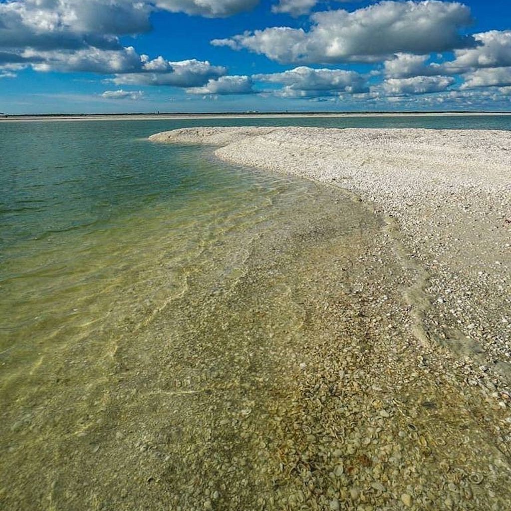
The trick out here is knowing which bar is producing, because it changes. The exposed outer sandbars on the Gulf-facing edge catch the swell and stack the heaviest lines — lightning whelks, fighting conchs, lettered olives, cockles, and pen shells, with horse conchs turning up on the wilder points. The oyster bars and creek mouths hold a different cast: crown conchs prowling the mud, and the egg cases and odd finds that come with a rich estuary. After a winter blow, the deeper-water shells push up onto the outer bars. We never promise the rare ones, but the everyday haul out here is the best-kept secret in Southwest Florida shelling.
| Spot | What you'll find |
|---|---|
| Outer Gulf sandbars | Whelks, conchs, olives, pen shells |
| Wild outer points | Horse conchs, larger finds |
| Oyster bars & creek mouths | Crown conchs, egg cases, estuary finds |
| After a winter front | Deeper-water shells on the outer bars |
Best tide and season
Out here the tide isn't just helpful, it's everything — it's what exposes the sandbars in the first place. A low or falling tide surfaces bars that are underwater an hour either side, giving you fresh, untouched shell lines that the next tide will rebury. December through March is prime, when cold fronts stir the Gulf and load the outer bars. Our captains plan the whole route around the tide chart so you step out onto a bar at its widest, fullest moment.
Why you need a boat — and a captain
This is the one place we'll firmly say: don't go alone unless you really know it. The Ten Thousand Islands look the same in every direction, the channels are unmarked, the water goes skinny without warning, and people genuinely get lost out here. It's also a protected wilderness, so it deserves a light touch. The right way to shell it is to ride out with a captain who has the maze memorized. We launch from Goodland or Marco, run you to whichever outer bar is producing that day, and bring you home through the mangroves at golden hour. And the rule rides along: Collier County means empty shells only. We want these bars to stay this good for the next boat too.
From the Helm: Threading Coon Key Pass into the Ten Thousand Islands on a dropping tide
Before a line ever comes off the dock in Goodland, our captains run through the same two checks every morning: which way the wind is blowing, and where the tide sits against the next few hours. A north or northeast breeze lets us tuck deep into the back creeks, where a wall of mangrove blocks most of the chop before it ever reaches the boat. A stiff southwest wind flips that plan, since it stacks a short, uncomfortable swell across the open stretches of Gullivan Bay we’d otherwise cross without a second thought. That single reading decides which mouth of the maze we run first.
Our usual line out runs through Coon Key Pass rather than the wider channels bigger boats favor, because the narrower cut keeps us close to markers we trust in water that reshapes itself after every storm. From there we ease across the open lip of Gullivan Bay toward the quieter cays near Dismal Key, watching the water shift from deep blue-green to a paler, sandier tint that means a shoal is close enough to matter. We idle that stretch rather than run it, because a chart drawn last season doesn’t always match the sandbar sitting under the hull this morning.
When the bar finally shows itself as a pale stripe breaking the surface, that’s the cue to cut the engine and let the hull go quiet for the last few yards. Guests usually go still right along with the boat, leaning over the rail to watch the bottom come into focus before anyone’s even stepped onto the ladder. We nose in slow enough to feel the keel brush sand rather than strike it, then swing the bow parallel to the beach so the whole group can step down together instead of climbing past each other at one ladder rung.
If that first back-creek stretch comes up thin, or another boat’s clearly worked it already that week, our captains don’t stand around debating it. We’d rather burn twenty more minutes running to a different cay than have a group stare at picked-over sand for the rest of the morning. Most of these islands don’t have names anyone remembers, just a bend in a creek or a bar tucked behind an oyster bed we’ve learned to check, and moving on costs a little fuel while buying back a fresher line most visiting boaters never find.
A shell that’s spent the last tide cycle in one of these back creeks instead of baking on a public beach still carries a faint smell of brine and mud, and the color hasn’t started chalking out in the sun yet. Whatever’s still living inside — and plenty is, out here — goes right back into the mud where it sat, empty shells only making it into anyone’s bucket. It’s slower hunting than a straight beach walk, and it rewards a captain willing to idle twice as long as the GPS says is necessary. A shelling tour built around this maze is the real way in; the wider shelling beaches guide covers the drive-up stretches closer to town.