
🏝️ At a glance
- Access
- Drive-up via the Sanibel Causeway (toll)
- Why it works
- East-west island orientation scoops Gulf shells onto the beach
- Diversity
- 250+ documented species (Bailey-Matthews National Shell Museum)
- Best time
- Low tide, after a winter cold front or storm
- Rule
- Empty shells only — Lee County, no live shells, sand dollars or starfish
Why Sanibel scoops so many shells
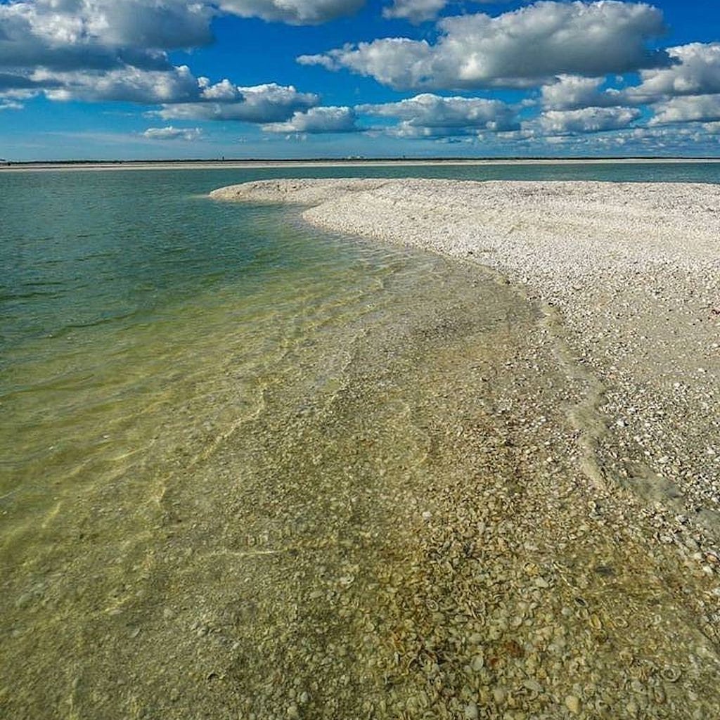
Most barrier islands run north-south and shrug the Gulf's shells right past. Sanibel turns sideways. Its long beach faces almost due south, so when waves and currents sweep up the Gulf coast, they hit Sanibel broadside and dump everything they're carrying. Add a wide, gently sloping shelf offshore and you get the famous shell ramp — the place where a whole afternoon of beachcombing can fill a bag with calico scallops, fighting conchs, lettered olives and the occasional lightning whelk. The Bailey-Matthews National Shell Museum has documented well over 250 species washing up along these few miles. That's not marketing. That's geology doing you a favor.
Where to shell on Sanibel
You've got three classic stops, and they each fish differently. Lighthouse Beach at the island's east tip is the easy first stop — it drifts shells on both the Gulf and bay sides, so kids can fill a bucket in twenty minutes. Bowman's Beach on the west end is the connoisseur's pick: a long boardwalk keeps the crowds thinner, and walking toward Blind Pass at low tide turns up the better shells. And Blind Pass itself, where Sanibel meets Captiva, is a genuine goldmine — those pass currents pile intact shells in the wrack line. Do the famous "Sanibel Stoop" (bent at the waist, eyes down) and you'll fit right in.
Best tide & season
Two things matter more than luck: tide and timing. Get there at low tide, when the falling water exposes the freshly stocked shell bars. And shell in winter (roughly December through March), when cold fronts churn the Gulf and shove fresh shells ashore overnight. The morning after a front blows through is the single best window on the calendar. A little wind from the right direction beats a calm sunny day every time. Bring a mesh bag so sand drains, water shoes for the shell-rubble stretches, and reef-safe sunscreen.
| Beach | Access | Best for |
|---|---|---|
| Lighthouse Beach | East tip, drive-up | Easy family stop, Gulf + bay drift |
| Bowman's Beach | West end, boardwalk walk | Thinner crowds, walk west for the best finds |
| Blind Pass | Sanibel/Captiva line | Intact, rarer shells in the pass current |
The honest post-Ian status
Hurricane Ian (September 2022) hit Sanibel hard, and we won't pretend otherwise. The causeway, beaches and businesses have reopened and the island is very much back in the shelling game — storms actually re-stir the offshore shell beds, so some folks report excellent finds. But you'll still see recovery work in places, and beach-access points can change. Always check the City of Sanibel for current parking and access before you load up the car. Honest expectation-setting is the difference between a great trip and a frustrated one.
Here's the thing, though: Sanibel is a drive. If you're staying around Marco Island or Naples, you don't have to make that haul to fill a bag. Our captains run guided shelling tours to boat-only islands like Keewaydin and Kice that almost nobody walks — same Gulf shells, fresh lines, no crowd. Sanibel made shelling famous; the Ten Thousand Islands keep it that way.
From the Helm: Sanibel by water: reading San Carlos Bay before the shell line ever starts
Before anyone on our boats gets to talk about Sanibel’s famous shell line, there’s a stretch of open water to read first. Running toward Sanibel from the south means crossing San Carlos Bay, where the wind has room to build a chop that a shallower run through the Ten Thousand Islands rarely sees. Our captains check wind direction as closely as speed before making that kind of run, because a stiff southwest breeze against an outgoing tide can turn a flat bay rough fast, long before you’re anywhere near a shell.
That’s a different read than the one we make daily closer to home, where mangrove-lined creeks and passes break up the fetch and keep the water flatter even on a breezy afternoon. Sanibel’s open-bay approach rewards patience — wait for a calmer morning window before the sea breeze fills in, or plan on a rougher ride than the forecast alone suggests. It’s one more reason many of our guests choose the sheltered shelling closer to Marco instead, especially with kids or anyone prone to seasickness aboard.
Captains running their own boats up that way lean on the depth sounder near the causeway pilings and the marked channel edges, since the bay shoals unevenly and a straight line across it isn’t always the safe one. We watch for diving birds working bait pushed against the flats as a rough gauge of where the water’s moving, because current lines there can shift a boat off its intended track quicker than the chart suggests, especially on a big outgoing tide.
We don’t run scheduled charters to Sanibel itself, but we hear about that crossing often enough from guests planning their own trip that our captains keep half an eye on the marine forecast for that stretch of bay the same way we do for our own runs. It’s useful knowledge for anyone making the trip by private boat rather than the bridge, and it’s the kind of read that turns a long, wet ride into a smooth one.
When that forecast doesn’t cooperate, our captains usually scrap the idea of Sanibel altogether and point the bow toward Keewaydin Island instead, which sits in protected water the whole way from our dock. It isn’t a consolation prize so much as a straight swap — still a barrier-island shell line, still a falling tide to time, just without hours of open bay to cross first. That flexibility is built into how we plan any given morning: the destination bends to the wind, not the other way around.
If a shorter, calmer boat-only run sounds better than that open-bay crossing, our shelling tours work the sheltered water around Marco instead, and our destination guides lay out exactly which islands you’d reach on a given morning — the same shell-line quality, a fraction of the open water to cross first.